A peak at the horizon
Published July 6, 2018
I’ve long been of the mind that AR is a far greater useful tool to humanity than VR will ever be - particularly since I had a go on the PlayStation VR equipment for just a couple of minutes and subsequently had to lie down for half an hour. That being the case, I’m trying to keep an eye out for awesome developments in AR apps, and PeakFinder is one of those.
The simple idea is that as you are walking around in the big outdoors, you point your phone in any given direction and get an overlay of what hills, peaks and mountains you are looking at. There are a few tweaks to give you greater views - raising your height above where you actually are being one of them - but generally, it’s just a great tool for placing yourself within the geography you are standing in.
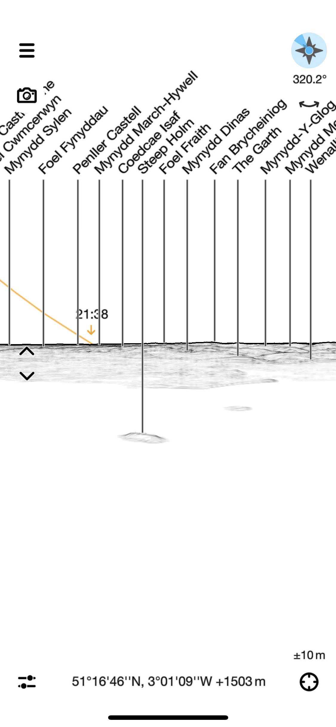
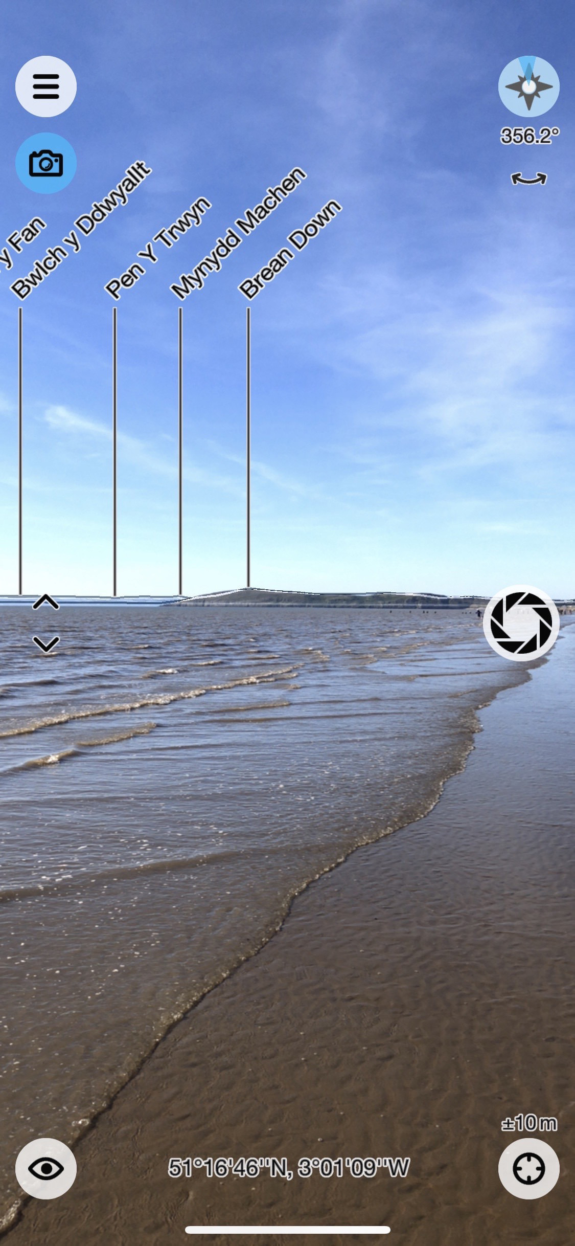
You can also toggle between the arty style drawing of your view, or in true AR fashion, overlay the notes on top of the actual camera images. I think I prefer this view.
The app makers also say:
PeakFinder shows a 360° panoramic view from an arbitrary viewpoint of your choice. To render the panoramic views PeakFinder uses an elevation model that is integrated into the App. A database with a peak directory is included as well. For these reasons PeakFinder does not need an online connection for rendering the panoramic view and works completely offline from anywhere in the mountains.
So if you do head up that mountain and find yourself without signal, you’ll still be able to know where you are!
The app simply adds an extra layer of information to your trip outside, and is a lot of fun to use. Most importantly, it helps to plot which peak you’re going to tackle next (or nice flat stretch of beach, if you’re anything like me).
